
Is Donner Pass open right now?
I-80 over Donner Summit: open or closed by direction, chain controls, live Caltrans cameras and the summit forecast.
As of Sat 6:46 PM PT, I-80 over Donner Pass is open with no chain controls in effect (Caltrans).
No chain controls are in effect.
- Eastbound, to Truckee and Reno: No chain controls
- Westbound, to Sacramento: No chain controls
Updated 6:46 PM PT · source: Caltrans (report as of Saturday 06:46 PM)
Caltrans report details
- A high wind advisory is in effect from New Castle Rd /in New Castle/ to Gold Run (Placer Co) - Travel is not recommended for campers, trailers, or permit loads
- All westbound trucks are required to stop at the brake check area 0.5 mi west of Nyack (Placer Co) - To reduced the risk of brake fires
The live report at the top of this page is the Caltrans status for Interstate 80 over Donner Summit: whether the pass is open, the chain-control level in each direction (none, R1, R2 or R3), and any holds, screening or wind restrictions, with the time of the last Caltrans check. It refreshes every few minutes. Always confirm with Caltrans (QuickMap or 1-800-427-7623) before you drive; conditions on the pass change faster than any page.
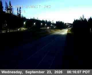 Live cam Donner Summit · I‑80 at the top of the pass 7,221 ft · Caltrans District 3 · the frame carries its own timestamp; this page reloads it about once a minute
 Donner Pass cameras: I‑80 live, westbound and eastbound
Caltrans District 3 runs traffic cameras along I-80 over Donner Pass. The four on this page cover the summit, the Donner Lake exit, Soda Springs and Kingvale, in driving order, and update about once a minute. Click any camera for the Caltrans page, or open Caltrans QuickMap for every camera on the route.
-
Donner Summit I-80 eastbound · the top of the pass 7,221 ft -
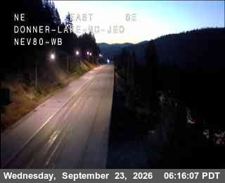
Donner Lake (Exit 180) I-80 westbound · the inn’s exit, just below the summit grade 6,394 ft -
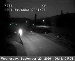
Soda Springs I-80 eastbound · the west side of the summit, by Boreal and Soda Springs 6,692 ft -
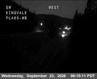
Kingvale I-80 westbound · where eastbound chain control usually starts 6,128 ft
Cameras go dark at night and white out in heavy snow, which is information too: if the summit frame is blank, check Kingvale, a thousand feet lower, to see where the snow line is. Each frame carries the time Caltrans captured it; this page reloads the frames about once a minute while the tab is open.
Are chains required on Donner Pass today?
- Eastbound, to Truckee and Reno: No chain controls
- Westbound, to Sacramento: No chain controls
Caltrans District 3 chain-control sensors, checked every five minutes.
The card in the chain-control section shows the current Caltrans level for each direction of I-80 over Donner Pass, read from the District 3 chain-control sensors every five minutes: no chain controls, R1, R2 or R3, and the stretch of highway it covers. Checkpoints sit at Kingvale eastbound and at the Donner Lake and Truckee interchanges westbound; on storm days they add a queue even when the pass is open.
Chains are sold and installed next door to the inn at the Donner Lake Gift Shop, 15688 Donner Pass Rd. How to carry, buy and fit them is in the getting-here guide and the winter travel FAQ.
What R1, R2 and R3 mean
- R1 Chains, or snow tires on two drive wheels
Chains on all vehicles except passenger cars and light trucks under 6,000 lb with snow-tread tires on at least two drive wheels. Vehicles on snow tires must carry chains; anything towing must chain one drive axle.
- R2 Chains on all but 4WD/AWD with snow-tread tires
Chains or traction devices on all vehicles except 4WD/AWD with snow-tread tires on all four wheels — and those must carry chains. Snow-tread means M+S, M/S or MS on the sidewall, which most all-season tires are. The most common level on the pass.
- R3 Chains on everything
Chains or traction devices on all vehicles, no exceptions. Caltrans usually closes the pass before it reaches R3.
Posted signs and the officers at the checkpoint have the final say (Caltrans chain controls). Staying for the storm? The Donner Summit resorts are 15 minutes up the hill — see ski lodging at the base of Donner Summit.
Donner Pass weather today: summit forecast, snow, wind advisories and high‑profile vehicle warnings
Caltrans posts high-wind advisories for I-80 over Donner Summit that recommend against travel for campers, trailers, box trucks and other high-profile vehicles, and the National Weather Service issues Wind Advisories and High Wind Warnings for the summit zones. Both appear on this page as soon as they are posted: the Caltrans advisory in the high-profile vehicle card and the NWS products in the watches and warnings card beside it.
- Tonight31°Widespread Frost
- Sunday53°Widespread Frost then Mostly Sunny
- Sunday Night33°Mostly Cloudy
- Monday47°Mostly Sunny
Widespread frost after 9pm. Clear, with a low around 31. North wind 2 to 6 mph.
National Weather Service point forecast for the summit itself (NWS Sacramento), refreshed with the road report. The summit runs colder and windier than the Truckee outlook below.
No NWS watches, warnings or advisories are active for the Donner Summit I-80 zone or the Greater Lake Tahoe area.
Zones: NWS Sacramento, Sierra Nevada above 5,000 ft including Interstate 80; NWS Reno, Greater Lake Tahoe Area.
- A high wind advisory is in effect from New Castle Rd /in New Castle/ to Gold Run (Placer Co) - Travel is not recommended for campers, trailers, or permit loads
Caltrans wind restrictions for campers, trailers, box trucks and RVs, from the I-80 highway report.
Wind matters as much as snow on this pass; the summit takes gusts that close the road to trailers while the lake below is calm. On Donner Lake itself an afternoon west wind builds most summer days, and NWS Reno’s Lake Wind Advisories cover it for boaters and paddlers.
Donner Pass traffic right now
Caltrans’ own QuickMap, live and centered on the pass: chain-control checkpoints, cameras, CHP incidents and closures. The Caltrans report at the top of the page is the official word.
When it backs up: eastbound Friday afternoon and evening and on holiday-weekend mornings; westbound Sunday afternoon into the evening, worst between Truckee and Colfax, and again late on a holiday Monday. On storm days the checkpoints add queues even when the pass is open — eastbound around Kingvale, westbound at the Donner Lake and Truckee interchanges — and Truckee’s Highway 89 and 267 junctions back up whenever the ski resorts let out.
Donner Pass Road (Old Highway 40) conditions: the lake road, not the interstate
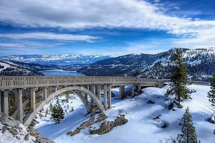
Donner Pass Road is not the interstate. It is the two-lane historic highway (old US 40, the Lincoln Highway alignment) that runs the length of Donner Lake’s north shore from Truckee, passes Donner Lake Inn at the west end of the lake, then climbs the switchbacks past Rainbow Bridge to Donner Pass, Sugar Bowl and Donner Ski Ranch before rejoining I-80 at Soda Springs. I-80 is the through route over the summit. Donner Pass Road is plowed in winter as the ski-area access road, but it closes in heavy storms and when I-80 shuts it is closed to through traffic rather than used as a bypass. It also closes for rockfall: a 2023 slide shut the stretch between the lake and the pass from June until Labor Day. The lake and switchback segments are maintained by the Town of Truckee and Nevada County; the county posts closures on its Road Conditions and Closures page (none listed when we last checked, September 8, 2026).
The I-80 exit for the lake is signed Donner Lake (Exit 180) and drops you onto Donner Pass Road at the west end of the lake, two minutes from the inn. The road’s history, overlooks and the Donner Summit Bridge (Rainbow Bridge) are in our Donner Summit historic corridor guide.
Truckee road conditions: Highway 89 and 267
Truckee’s streets, including the Donner Lake neighborhoods inside the town limits, are plowed by the Town of Truckee; arterials first, side streets after. The two state routes out of town are Caltrans roads with their own chain controls: Highway 89 south to Tahoe City and Palisades, and Highway 267 over Brockway Summit (7,179 ft) to Northstar and Kings Beach, which typically goes to chain control in the same storms as Donner. County roads outside town are Nevada County’s.
- Highway 267 over Brockway Summit (Truckee–Kings Beach): no chain controls
- Highway 89 south (Truckee–Tahoe City): no chain controls
Caltrans District 3 sensors at the Truckee junctions, checked every five minutes.
If chain control or a closure catches you
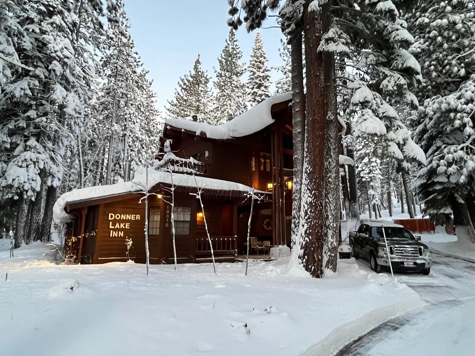
Chains are sold and installed next door at the Donner Lake Gift Shop (15688 Donner Pass Rd), a few doors from the inn. Donner Lake Inn is at the west end of Donner Lake, about 4 miles below the pass on the Truckee side — Exit 180, one exit below the summit grade. If you’re already over the pass, or you’ve been turned around at the Truckee hold, we can usually take same-day arrivals: 5 rooms with private entrances, a gas stove in each, breakfast included, and a creekside hot tub that runs all winter.
Call and a real person answers; if we’re full we’ll tell you who nearby isn’t. Road questions go to Caltrans at 1-800-427-7623; room questions come to us.
Alternate routes when I-80 closes
Most I-80 closures over Donner Pass last a few hours (spinouts, jackknifed trucks, avalanche control) and traffic is held at Colfax or Applegate westbound-side and at Truckee or Reno eastbound-side; waiting usually beats detouring. For a long closure the alternatives are US-50 over Echo Summit (7,382 ft) to South Lake Tahoe, then Highway 89 or 28 around the lake to Truckee, roughly two hours longer from Sacramento; or Highway 88 over Carson Pass (8,574 ft) to Minden, then US-395 to Reno and I-80 west into Truckee, longer still. The honest note: both usually go to chain control or close in the same storms.
Sources
Live statewide map of chain controls, closures, incidents and cameras — the definitive picture of I-80 over the pass.
The text report this page quotes, refreshed every few minutes. By phone: 1-800-427-7623.
Closures, spinouts and holds as they happen — the Truckee CHP office posts storm updates faster than anyone.
Forecast, wind advisories and winter storm warnings for Donner Lake, Truckee and the Greater Lake Tahoe zone.
Forecast for the summit itself: the Sierra Nevada above 5,000 ft zone that includes Interstate 80.
Donner Pass Road (Old 40) and other county roads: closures, rockfall and construction notices.
Roads clear? The hot tub’s hot.
Full directions and winter-driving tips are in the getting-here guide. Questions on the way up? Call — we’re here.